is a numerical prediction method that is used to attempt to generate a representative sample of the possible future states of a dynamical system. Ensemble forecasting is a form of Monte Carlo analysis: multiple numerical predictions are conducted using slightly different initial conditions that are all plausible given the past and current set of observations, or measurements. Sometimes the ensemble of forecasts may use different forecast models for different members, or different formulations of a forecast model. The multiple simulations are conducted to account for the two sources of uncertainty in weather forecast models: (1) the errors introduced by chaos or sensitive dependence on the initial conditions; and (2) errors introduced because of imperfections in the model, such as the finite grid spacings.
Considering the problem of numerical weather prediction, ensemble predictions are now commonly made at most of the major operational weather prediction facilities worldwide, including the National Centers for Environmental Prediction (US), the European Centre for Medium-Range Weather Forecasts (ECMWF), the United Kingdom Met Office, Meteo France, Environment Canada, the Japanese Meteorological Agency, the Bureau of Meteorology (Australia), the China Meteorological Administration, the Korea Meteorological Administration, and CPTEC (Brazil). Experimental ensemble forecasts are made at a number of universities, such as the University of Washington, and ensemble forecasts in the US are also generated by the US Navy and Air Force.
Ideally, the relative frequency of events from the ensemble could be used directly to estimate the probability of a given weather event. For example, if 30 of 50 members indicated greater than 1 cm rainfall during the next 24 h, the probability of exceeding 1 cm could be estimated to be 60 percent. The forecast would be considered reliable if, considering all the situations in the past when a 60 percent probability was forecast, on 60 percent of those occasions did the rainfall actually exceed 1 cm. This is known as reliability or calibration. In practice, the probabilities generated from operational weather ensemble forecasts are not highly reliable, though with a set of past forecasts (reforecasts or hindcasts) and observations, the probability estimates from the ensemble can be adjusted to ensure greater reliability. Another desirable property of ensemble forecasts is sharpness. Provided that the ensemble is reliable, the more an ensemble forecast deviates from the climatological event frequency and issues 0 percent or 100 percent forecasts of an event, the more useful the forecast will be. However, sharp forecasts that are unaccompanied by high reliability will generally not be useful. Forecasts at long leads will inevitably not be particularly sharp, for the inevitable (albeit usually small) errors in the initial condition will grow with increasing forecast lead until the expected difference between two model states is as large as the difference between two random states from the forecast model's climatology.
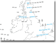
There are various ways of viewing the data such as spaghetti plots, ensemble means or Postage Stamps where a number of different results from the models run can be compared.
Wikipedia, Ensemble forecasting,
http://en.wikipedia.org/wiki/Ensemble_forecasting (optional description here) (as of Feb. 9, 2010, 20:30 UTC).


